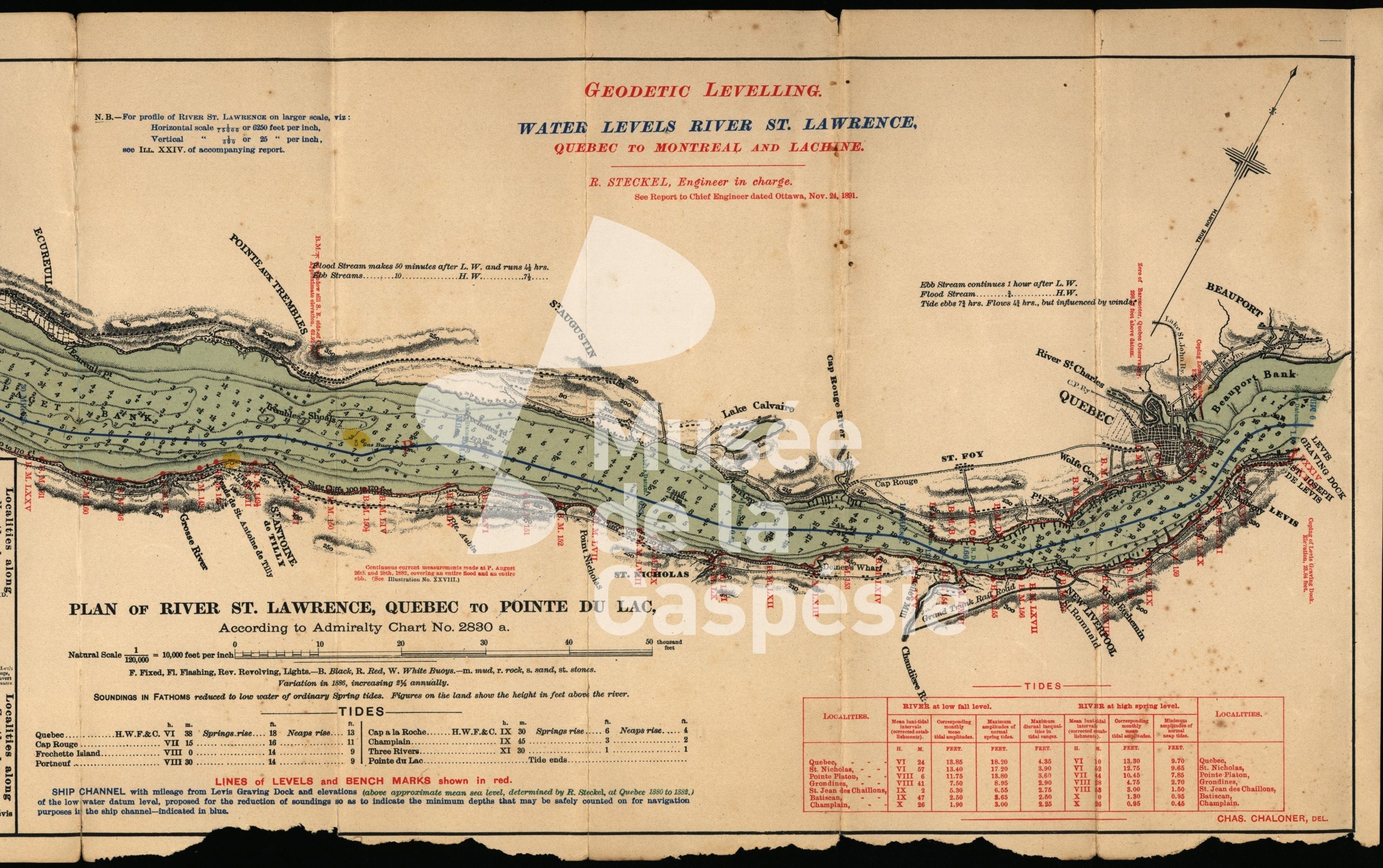
Nautical chart from Québec City to Pointe-du-Lac

Visited: 2 times
Order
24 novembre 1891. - Exhibit consisting of a nautical chart of the St. Lawrence River, from Quebec City to Pointe-du-Lac, showing the water levels along this portion of the river. Multiple scale.

Reference :

Musée de la Gaspésie. Fonds Famille Daniel Mabe. P68/1c/7/1/1.

Leave a Reply

Your email will not be published. Required fields are marked with a *

For security, use of Google's reCAPTCHA service is required which is subject to the Google Privacy Policy and Terms of Use.

I agree to these terms.